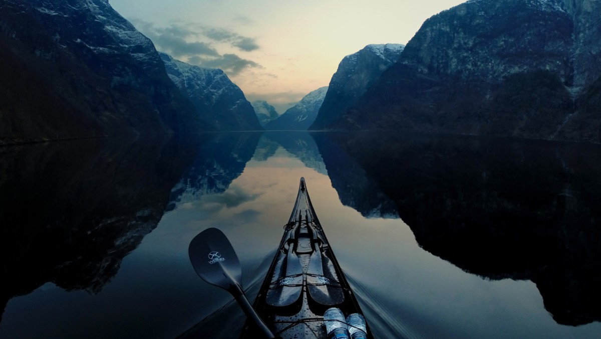

June 1990: My friends and I pull up our sea kayaks on the sandy pocket beach of Steves Island, in Maine’s eastern Penobscot Bay. Before digging around in our dry bags for lunch, we take the grand tour. There are no trails cutting through the interior, so we clamber from one granite rock to another around the perimeter. We marvel at how many of the evergreen-covered islands of the Deer Isle archipelago we can see from this one-acre islet. Steves is owned by Maine’s Bureau of Parks and Lands and is open to the public, so we scout out potential tent sites. The only clearing we find is just big enough for a couple of two-person tents.
June 1993: We stop at Steves for lunch. We are surprised to find trails threading through the interior,
leading to some new clearings. The steep bank above the beach shows some signs of erosion.
June 2000: During a late morning snack break on Steves, we notice that more of the soil along the bank has fallen away, leaving tree roots exposed. In the interior, the lower limbs of trees have been cut to create additional clearings; there are now six campsites. Two kayakers have arrived before us. Only in recent years have we met other boaters when visiting the island. We’re a bit taken aback when one of the kayakers pointedly asks us how long we’ll be there.
‘On a trip last summer, the expansive
open space reminded me of a mainland campground.‘
The first time I paddled to Crow Island in Muscongus Bay was in 1988. My friends and I were the only visitors. We pitched our tents right next to each other because clearings on the island were so limited. On a trip last summer, the expansive open space beneath the tree canopy reminded me of a mainland campground. Similar recent environmental damage is evident on many other Bureau of Parks and Lands islands along the Maine coast.
Increased recreational use of public lands is not a problem unique to the islands of Maine. Those grappling with similar concerns in coastal areas frequented by boaters may find the steps being taken to manage Maine’s public islands instructive.
Increasing numbers of visitors
Vacationers have long enjoyed traveling along Maine’s dramatic coastline. In the last several years, many have found ways to get beyond the mainland to explore the neighboring waters and islands. They are climbing aboard windjammers, paddling their own sea kayaks, or joining outfitted kayak expeditions. Ten or fifteen years ago, a sea kayak on the roof of another car was a rare sight on our stretch of Interstate 95, and would elicit much arm-waving. Today on summer weekends here in Maine, sea kayaks on top of cars seem almost as common as RVs heading to Acadia National Park. The number of sea kayak outfitters with Registered Maine Guides has grown from six companies ten years ago to thirty this year.
A recent Maine State Department of Tourism advertising campaign was designed to appeal specifically to kayakers. The ad read: “Get out of your car to truly see Maine. 64 lighthouses. 2,000 islands. 5,000 miles of coast. Zero deadlines. It would take a lifetime to paddle it all. Take your time. It will be here, just like it’s been forever.” But will it be here, “just like it’s been forever,” if tourism promotion leads more people to a limited number of public wild islands?
The Maine Island Trail Association
The Maine Island Trail Association (MITA) was founded in anticipation of this recreational pressure on Maine’s public islands. In 1987, well before the explosion of sea kayaking in New England, the Bureau of Parks and Lands (BPL) charged MITA with maintaining a water trail. Thirty-five BPL islands deemed suitable for recreational use formed the backbone of the Maine Island Trail, the first recreational water trail in North America. In subsequent years, so many individual owners offered to share their islands with MITA members that the numbers of public and private islands on the trail today are nearly even. Association members can start a cruise in Portland and travel northeast along 325 miles of the rocky Maine coast, to within twenty miles of the Canadian border. Along the way, they can overnight on some of the 87 islands within the trail network.
One of the challenges MITA has faced since its inception has been to protect the wildness of islands while providing recreational access to them. A basic tenet within the association has been that along with the privilege of access comes the responsibility of taking care of the islands. Members learn about low-impact practices to employ on the islands, so their visits will be undetectable by future visitors. Some “adopt” favorite islands and make regular stewardship trips; others travel in MITA motorboats to monitor use in specific regions. They clean shorelines of washed-up plastic oil containers, Styrofoam cups, bits of monofilament rope, soda bottles, and the like. By their examples, members hope to inspire others to treat the islands gently.
Anyone, not just MITA members, is welcome on the BPL islands within the trail, and it is these public islands that are showing the most evidence of overuse. People are traveling to them not only by kayak, but by motorboat, canoe, private sailboat, and windjammer. Many members log their observations regarding visitor numbers for inclusion in MITA’s usage statistics. Rachel Nixon, MITA’s Trail Manager, has analyzed the observations that members have submitted over the past several years. “We have found that the number of visitors to BPL islands has increased by 40% since 1995,” says Nixon.
Effects of increased use
The effects of increased island usage on the Maine coast fall into two categories: environmental and social. Many of Maine’s public islands are small, fragile places. The soil is thin over the granite subsurface and the vegetation is exposed to howling winter winds. Foot traffic and careless campsite creation lead to environmental degradation such as erosion, soil compaction, tree root exposure, tree limbing, and vegetation trampling. Islands that ten years ago showed little evidence of human visitation may now have several campsites and trails, along with the attendant damage resulting from their creation.
The social impacts of increasing numbers of island visitors present potentially more difficult challenges. Nixon cites competition for campsites and tension between different camping groups as growing concerns. “I’ve heard reports of kayak groups heading out in motorboats a day in advance to stake their ‘claim’ to campsites by setting up their tents,” Nixon says. She notes that there can be tension between a small group and a larger, more “dominant” group overnighting on the same island. “We have seen new pocket campsites develop away from the main camping area,” she says. “These sites may have been created by small groups or individuals seeking a quieter experience away from other campers.” Another source of tension can derive from different ideas of what constitutes a good night out on an island; some visitors anticipate spending a quiet evening observing their surroundings, while others look forward to a good party.
Usage management
In the mid2990s, MITA started recommending that island visitors travel in small groups and limit their stays to two or three days. The association began working informally with kayak outfitters, schooner captains, and coastal communities to educate island visitors about low-impact techniques, to slow the environmental decline associated with higher levels of use.
The Maine Island Trail Association and the Bureau of Parks and Lands determined that more specific island usage guidelines were needed to help protect the island environments and visitors’ wilderness experience. In 1999, they launched the Maine Island Usage Management Project, a collaborative endeavor aimed at “protecting the future ecological health and recreational availability of Maine’s public coastal islands by empowering visitors to self-manage use.”
MITA and BPL staff members believed that the key to the project’s success was to partner formally with island stakeholders, such as outfitters, land trusts, government agencies, and others concerned about the public islands, to develop viable solutions. “We realized that the best way to ensure compliance with recreational use guidelines out on the islands was to engage the island stakeholders themselves in the planning process,” says Nixon. MITA began hosting public forums and advisory committee meetings to tackle the issues.
One of the outcomes of the project is a set of specific camping capacities for the public islands. The capacity figures are based on environmental and social carrying capacities. They attempt to quantify how many visitors an island can accommodate without further damage, and how many people can camp there without feeling crowded.
‘One result of the project is the posting of signs on the BPL islands that describe “Leave No Trace” low-impact principles‘
After the Bureau of Parks and Lands approved the capacity guidelines, MITA published them in its guidebook and posted them on the islands. Steves Island, for instance, is considered “full” if twelve people set up camp there. Compliance with these guidelines is voluntary. Visitors are encouraged to politely squeeze into existing campsites if capacities have been met but they feel time, distance, or weather conditions make it unwise to look for another place to spend the night.
Another result of the usage-management project is the posting of signs on the BPL islands that describe “Leave No Trace” low-impact principles. (See page 49 of magazine.) These principles address topics such as walking on durable surfaces, camping at existing sites, packing out trash and human waste, minimizing the effects of campfires, being respectful of wildlife, and being considerate of other visitors and those living and working on the coast.
Steve Spencer is the Outdoor Recreation Specialist for the Bureau of Parks and Lands, and had a hand in setting up the Maine Island Trail. According to Spencer, “We are fortunate that a large majority of island visitors, both professionally and privately led, are extremely responsible and considerate. This gives us hope that voluntary compliance and education will eliminate the need for enforcement and reservation systems.” He believes that by giving users the information they need to manage their own use, they will act with goodwill in the best interests of the islands and themselves.
Kayak outfitters also hope that by being proactive, they can avoid regulation of their operations. The Maine Association of Sea Kayak Guides and Instructors (MASKGI) is one of the groups that partnered with MITA and BPL to develop the camping capacity figures. According to Natalie Springuel, the president of MASKGI, association members have pledged to limit the number of clients they take to public islands to comply with the capacity guidelines. “We are very committed to minimizing impacts to the islands we visit,” says Springuel. “We instruct all our clients in ‘Leave No Trace’ practices.” MASKGI members review their trip schedules and itineraries with each other, to avoid having two guided groups competing for campsites on the same island. Some of the outfitters have made arrangements to camp on private islands, thereby reducing their impact on public campsites. Unfortunately, only half of Maine’s sea kayak outfitters currently belong to MASKGI.
To further reduce demand for space on the public islands, the Maine Island Trail Association is encouraging people to rethink the way they use the water trail. MITA recently added several mainland camping spots to the trail. A few are commercial facilities, while others are private properties made available by their owners at no charge. MITA also promotes day-tripping from mainland lodgings and campgrounds as an alternative to island camping. Day-trippers are much less likely to cause environmental degradation during their short visits, and they don’t contribute to the social pressures of too many overnighting campers.
We are not alone
In the past, the Maine Island Trail Association and the Bureau of Parks and Lands were hesitant to implement strategies on the public islands that might detract from the natural setting and interfere with the feeling of wilderness. They generally restricted intervention to cleaning the shorelines of washed-up debris and identifying each island with a small blue BPL sign. MITA posted the “Leave No Trace” guidelines on each island two years ago. As part of the Maine Island Usage Management Project, staff members and volunteers are beginning to “harden” some of the camping spots, to limit the spread of environmental damage. They erected a tent platform on busy Hell’s Half Acre Island last summer, and plan to build other tent platforms to concentrate use. On some islands, specific clearings have been designated as the only permissible sites, and they may be bounded by logs or rocks to prevent further “campsite sprawl.” Nascent tent sites may be covered with brush to allow vegetation to recover, or they may bear “closed” signs. The newest site we discovered on Steves Island, for example, will be covered with brush. Maps will be posted to show the locations of acceptable tent sites, and on a few islands the individual sites also will be marked.
‘When we first started kayak camping, we felt like explorers; now we have come to terms with the reality of growing numbers of people wishing to camp as well.‘
A caretaker will live on popular Jewell Island in Casco Bay this summer, and educate visitors there and at a few neighboring BPL islands about low-impact use and campsite selection. On-site caretakers may look after other public wild islands in the near future.
Because of the levels of use these islands are receiving, more signage, campsite hardening, and on-site caretakers are all justified and useful additions. “While they may detract from the sense of wilderness, these measures acknowledge that there are potential problems and that the managers of these natural resources are addressing them. They show that the managers care about the islands, and hopefully this sense of caring will be transferred to the users,” notes Springuel. These measures will make it harder for users to play the “we’re the first people to land on this island” game, however. When I first started kayak camping along the Maine coast fifteen years ago, there were very few other boaters stopping on the islands. My paddling partners and I did feel like explorers, the first to set foot on these intriguing wild places. There was little evidence to the contrary: no fire rings, no matted tent sites. If we had done some reading, though, we would have learned that many of these islands were farmed, logged, or quarried over one hundred years ago, so the “wilderness” is actually of recent vintage.
While exploring the islands, the only people we would see were members of our own group. We’d walk island perimeters ringed with fragrant pink rogusa roses or sift through colorful stones and periwinkle shells tumbled by the ten-foot tides. We’d find six-inch-wide starfish clinging to mussels at low tide, see seals hauled out on nearby ledges, or spot harbor porpoises arching through the water. We’d hear lobster boats roaring out of the harbors in the morning, and see an occasional sailboat or skiff pass by, but otherwise we were out there on our own. The sense of having the islands to ourselves started to change over time. On one trip, a friend and I set our tents off to the side when we found two local families with motorboats using Hell’s Half Acre’s central campsite. No sooner had we staked down our tents than the crew of a windjammer dropped anchor and ferried their twenty-five clients ashore for a lobster bake on this tiny island. (At least they offered us leftovers!) On another trip, our destination island was already occupied by a kayak outfitter and her clients. While the guide had thoughtfully clustered their tents together, leaving room for late arrivals, we felt that there was barely room to turn around without running into someone. It was not the wilderness experience we had envisioned, and some of us decided to make it a day trip instead of an overnight.
‘Ultimately, what may serve us best is to change our expectations.‘
On future camping trips to Maine’s public islands, we will have to come to terms with the reality of growing numbers of people wishing to camp as well. We’ll still have to rely on our paddling and navigation skills; we’ll still have to hope the tent doesn’t leak and that someone remembered to pack the cook stove. But the experience often will be less one of solitude, and more one of cooperation.
If we arrive at a public island and the camping capacities have already been met, we’ll need to determine whether we can safely reach our second-choice island. When we arrive at our second-choice island, we’ll need to consider the possibility of another group’s arriving later at “our” island, and leave room for them as we set up our tents on one of the designated or hardened campsites.
Even when we are day-tripping, we may paddle past a BPL island because there are already boats pulled up on shore. We’ll also continue past islands that would seem to offer good landing spots, because they may be privately owned or they may provide nesting seabird habitat. Instead, we’ll plot a course to one of the other islands that have been specifically identified as suitable for low-impact day use. Visitors are welcome at certain islands owned by The Nature Conservancy, Acadia National Park, and local land trusts. (Fires and pets are either prohibited or discouraged on these islands, and camping is not permitted.)
Finding solitude
As more and more people head out into Maine’s coastal waters, there are still ways to find solitude. My paddling partners and I plan some of our paddling trips for the off season. While it can be windier, we do avoid the crowds. It is surprising how few recreational boaters are out before the middle of June and after Labor Day. Kayaking midweek also helps, except in vacation destinations such as the Deer Isle/Stonington area and Muscongus Bay.
Harder-to-reach islands can be much quieter than those closest to launch ramps. With the exception of congested Jewell Island, the most heavily used islands are within four miles of a put-in. When we travel “down east” beyond Maine’s population centers, we spot far fewer kayaks on roof racks.
The private islands on the Maine Island Trail may provide the wilderness experience lacking on some of the public islands. Members of the association have permission to camp on these islands as well. The MITA guidebook provides information regarding the special conditions for use placed on the private islands by their owners.
We can spend a peaceful morning or afternoon exploring a day-use-only island, leaving in time to head home or back to a mainland campground or bed and breakfast. Islands that are popular with campers can be delightfully uncrowded at midday.
Changing expectations
Ultimately, what may serve us best is to change our expectations. We can be pleasantly surprised when we are the only campers on an island, or when we stop for lunch and no one else is around. We can look forward to meeting fellow travelers and hearing their paddling tales. We can reduce our demand on the islands by focusing on day trips instead of camping trips.
Assuming boaters heed the Maine Island Trail Association’s ongoing education efforts and comply with its usage management guidelines, we should be able to enjoy the privilege of visiting Maine’s public wild islands for many years to come. Even though the islands may provide a slightly diminished sense of wilderness, these precious natural resources still offer an enchanting experience well worth preserving.