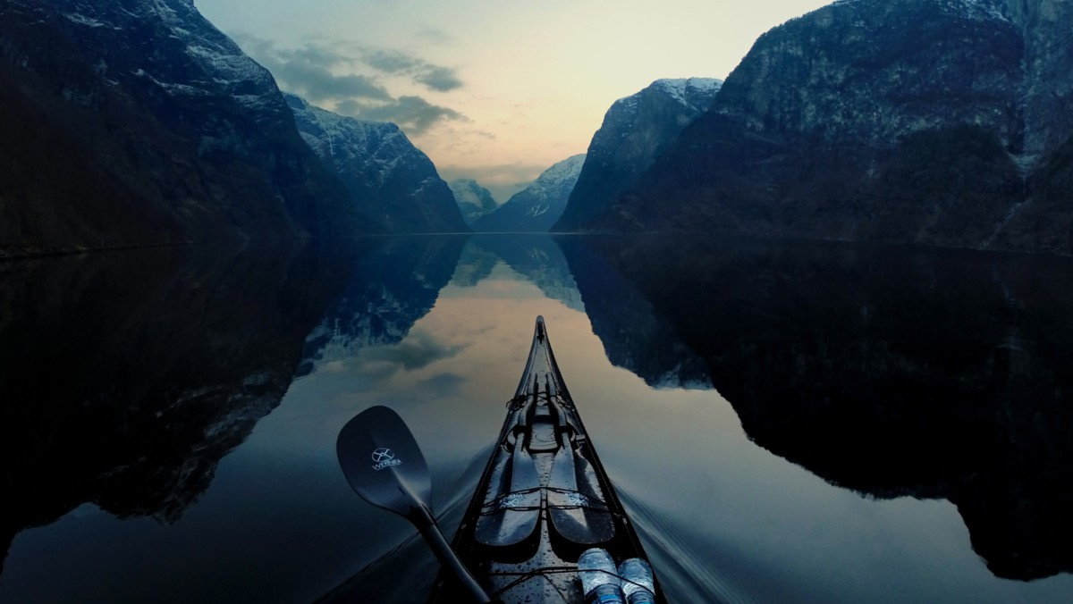

Though I log most of my paddling hours in the ocean, the idea of river travel has appealed to me ever since my mom read Mark Twain’s Huckleberry Finn to me when I was a kid. Piloting a boat on moving water that carves a sinuous path through ever-changing scenery offers peace, solitude and an intimate connection with the landscape, all for only a fraction of the exertion of paddling still water.
 But what I find most alluring about river travel is the idea of using the forces of nature to go somewhere. A river is like a conveyor belt. Get aboard it, and it will take you places hundreds, even thousands, of miles downstream. In 1994, I set my kayak in the headwaters of the Missouri River. Seventy-seven days later, it had carried me 2,500 miles to its confluence with the Mississippi. Looking back, I was terrifically unprepared. But time and necessity forced me to learn, and later to recognize problems before they occurred.
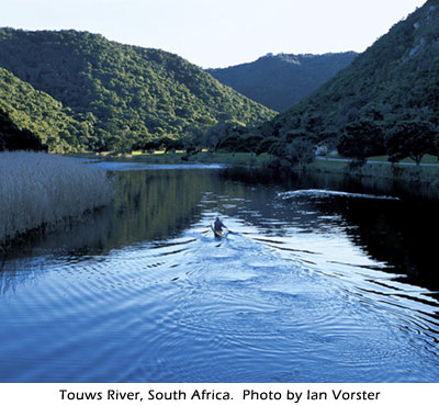
I made more than a few mistakes, but the inevitable mishaps are a small price to pay for the pleasure a scenic river has to offer. Because sea kayaks lack the maneuverability of comparatively short, whitewater kayaks, our focus here is on navigable rivers that are high on beauty and low on the risks inherent with fast-moving water. Still, even the tamest river has some hazards you’ll need to consider before striking out on your own.
It’s important to learn as much as you can about the river before you get wet. Good maps are a must—not because it’s easy to get lost on a river, but because you need to know what you’ll encounter downstream. Are there dams, bridges, locks, rapids or sharp, turbulent bends coming up? Are there wide reservoirs where the wind can whip up a chop? Where are the best places to camp or take out? A map will tell you what you need to know beforehand so you’ll have time to get in position to avoid hazards or come safely ashore. Even on slow-moving rivers, you need to allow yourself time to move to the side of the river that will take you where you want to go.
A river outfitter near the waterway you intend to paddle is likely a good place for maps and information. If that’s not possible, go to www.usgs.gov to order U.S. Geological Survey maps. To find a listing of U.S. Army Corps of Engineers maps, go to http://bookstore.gpo.gov/, type “maps” in the search engine, and a watery wilderness unfolds before you. These sites will also give you the water levels, continually updated from data recorded at gauging stations along the rivers. That’s important because if the river you want to paddle is barely deep enough to wet your aqua socks, you’ll need to alter your plans. In addition, www.outdoor-resources.com/rivers features trip reports, maps and other recommendations about rivers across the country.
Not typically being one for lots of planning—I tend to subscribe to the “get up and go” philosophy—I did do a fair bit of planning before my Missouri River paddle, but it wasn’t enough. When I arrived at the Red Rock Reservoir (the true source of the Missouri) in southwest Montana on April 3, huge patches of ice made paddling all but impossible. When I’d left my home in New York City, birds had been chirping and buds blooming; in Montana, it was still bitterly cold even during the warmest part of the day. I was able to put in below the dam in the swift current of the Beaverhead, but if I’d made a few more calls (this was before the Internet), I’d have planned to arrive later and would have shivered a whole lot less.
Just as important as knowing how to read your map is making sure you maintain “contact” with the cartography when you’re on the water. This is particularly useful on vast tracks of the Missouri through Montana, where it can be a week’s paddle between towns. If you know, for example, that there are three bridges, two islands and a tributary along the route—all marked on a detailed topo map—you’ll not only know when you’re nearing your destination, but you’ll eliminate a lot of the guesswork that can be stressful. If you have the Army Corps of Engineers charts in a clear plastic casing on the deck of your boat, you can even count the bends in the river for a more precise location. Like coastal waters, navigable rivers also have aids to navigation—day markers, lights and buoys—that you can use to find your location on the chart.
On rivers with huge reservoirs like the Missouri and Mississippi, a GPS will come in handy, especially if fog rolls in. Remember to take a compass as well, and know how to use it. If you don’t, count on your GPS to die in accordance with Murphy’s Law of Electronic Navigation.
Before I set out on the Missouri, a friend who grew up paddling out west warned me to tie my boat down even if I just needed to take a step away to relieve myself. A boat carried away by an ocean tide may drift off slowly, but a river will not give you the luxury of turning your back on an unsecured kayak.
Rivers aren’t subjected to tides, but a number of factors can change the level of the water. During my Missouri River trip, I camped on the shore of Lake Oahe, a 230-mile-long reservoir in the Badlands of North Dakota. I had pitched my tent about 100 yards from shore. When I crawled into my sleeping bag, the lake was flat. By midnight, lightning flashed across the sky and whitecaps rolled across the lake and around my tent. Bobbing in the chop was my loyal kayak secured to a downed tree; the rope was pulled as taut as a leash restraining a rabid dog. If I hadn’t tied it to the tree, it would have been long gone by the time I peeked out of my tent.
Rainfall is the other big variable to consider when you’re camping along a riverbank. One night I set up my tent on a small empty island smack dab in the middle of the Missouri. After an all-night rain, I emerged to find precious little dry real estate. In addition, if you’re on the water when the heavens open up, beware that the run-off can dislodge tree trunks, branches and other debris that can cause an impasse at a tight bend, in front of a sand bar or around a lock.
GO WITH THE FLOW OR GO SLOW
Even with navigable rivers, it’s important to know how to read the water and learn how to negotiate the bends in the river. If you’ve done some whitewater boating, you’ll know what to look for, though the telltale signs may be subtler. If you’re new to river paddling, you’ll soon learn that, on serpentine sections, the fastest water runs along the outside of the bend. The banks there are often steep as the river cuts into the land. The water on the inside of the bends moves slowly, often depositing sediment and creating gently sloped sandbars. On the straighter sections of the river, the quickest line is in the center, or in the deepest section of the river. If you’re heading downriver and you see white riffles—this generally means rocks—look for the downstream (or upside down) V in the water and shoot for the middle. “Go with the flow” and you’ll make good time downstream. If you’re paddling upstream, you’ll hug the inside on the tight turns and run the bank that sports the slower water.
There are a few things that will mess up your flow: downed trees, rocks, logjams, shopping carts, wrecked cars and beaver dams, to name a few. The key to safe river paddling—to be painfully obvious—is to avoid obstructions. The best way to do that is to anticipate hazards and make your move well upstream of them.
Let’s look at the most common hazards you’re likely to encounter along the way: Overhanging branches, if they’re not too low, are generally innocuous. On a narrow river, I often have to cruise under the highest part of the branch; on a wider river, it’s easy to avoid them completely. The key here is to make sure you don’t pass too close under a dangling branch and get snagged. If the branch is low, lean forward, not back. You’ll be better off if you take a scrape on the back of the head than on your face.
Estimating the clearance accurately may be tricky, so give yourself a healthy margin for error.
Paddling on the Susquehanna in central New York last spring, I ducked under a branch. I didn’t duck low enough, evidently, because it hooked the shoulder strap of my PFD and plucked me out of the boat. The bad news is that it was March and the frigid water took my breath away. The good news is that my paddling partner that day has only to think back to that hilarious moment when he’s feeling blue and cheers up instantly.
As rivers erode their banks, they often undercut trees. The trees will fall into the river but stay rooted to the bank. They become what whitewater boaters call sweepers or strainers. They’re downed trees that create a picket-fence barrier of branches that allows water through but won’t let your boat pass.
If you can’t avoid a strainer completely, paddle as far from the trunk as possible to get away from the larger, stiffer branches. If the current pushes you against the strainer or any obstruction, lean downstream toward the obstacle and try to hold on long enough to quickly assess the situation and get yourself out of harm’s way. Leaning upstream away from the obstacle is likely to lead to a capsize and may trap you underwater.
On the Missouri, where the dams are large and easily seen from a distance, I came to see them as both a blessing and a curse. A blessing because it meant I’d be able to leave the work of paddling still water and get back to going with the flow; a curse because it was time to get out and walk—a sizeable chore with a fully loaded kayak.
While most of us think of dams as large visible walls rising above the river, that’s not always the case. Wing dams, which are typically stone jetties built perpendicular to the shore to narrow the channel and increase the current, are often a hazard because they’re unmarked and frequently underwater when river levels are high. On wide stretches of a working river, you’ll be fine if you paddle near the middle (but stay clear of the marked channel used by larger boats). If you’re near the bank and spy a marked change in the pattern of the river, beware. Some obstruction may be lurking just below the surface.
Smaller dams that let water spill over may look runnable, but the recirculating water at the bottom of the dam is an accident waiting to happen. Known as “keepers,” this tumbling water can trap and submerge small craft. Always consult your map to see if there’s a dam on your route; if so, look for signs that tell you where to take out and portage around it.
Diversion dams shift the river to a canal and raise the water level without creating a significant pool of still water. On the Missouri, I learned this the hard way. Though I noticed a diversion dam was marked on my map, I didn’t know what one looked like. As I headed downstream, the submerged barrier was nearly invisible. I noticed that the river had slowed down some and I heard the rush of water, but I discovered the four-foot drop over the dam only when it was too late to avoid going over it. I splashed down on the other side, my heart racing. A motorist who’d stopped to watch honked with delight. I flashed him the cool-guy thumbs up and thanked the God of Diversion Dams for not shattering my boat. I have yet to make that mistake again.
Revetments, sections of large riprap stone lining the banks, are built to redirect the flow of the river and to prevent bank erosion. On the lower Mississippi, for example, it can be difficult to get out of these channelized sections, especially if there’s a lot of boat traffic nearby. Revetments are usually marked on river charts, so you’ll know where they are and can plan your day so you don’t get trapped on the river when it’s time to come ashore for lunch or find a place to crash for the night.
On navigable rivers, dams are accompanied by locks that carry boats between the upstream and downstream sides of the dam. On the Lower Saranac River in upstate New York, for example, the locks are small and fill up relatively quickly. Look for the lockmaster or a sign instructing you how to “lock through.” When locking down, the water stays pretty quiet, but be prepared for some turbulence when locking up.
With some of the larger locks, it can be quicker to carry around, especially if there are boats in front of you. Paddling up the Mississippi, I came to the massive lock at Alton, Illinois, the historic river town near the confluence of the Mississippi and Illinois rivers. The carry through town seemed nightmarishly long. On the other hand, the lock was designed for boats approximately 1,082 feet longer than my craft. I told the lockmaster what I was up to and he said that if I didn’t mind sharing the space with a supertanker, I was welcome to paddle on in. And so I did. An hour later, after graciously allowing this floating city block to exit first, I paddled up river to the less hectic Illinois.
After a fair bit of paddling on rivers near and far, I’ve come to the conclusion that the most dangerous hazard on the water is posed by other vessels. Rivers can get very busy with barges, tugs, tankers, ferries and, especially on a sunny summer weekend, speedy pleasure boats. Keep your eyes and ears open, just as you would in a busy coastal port.
There is an unusual phenomenon created by large boats on rivers that you don’t find on larger bodies of water. Two months into my trip on the Missouri, I rounded a bend and a long tow of barges—silent, and all but hidden in dusk’s grainy light—loomed over me like a five-story building, moving fast. I’d been warned that water gets sucked into the “vacuum” created by barges pushing upstream. The river ahead of the barges quickly recedes from the bank—stranding you if you’re too close to shore—to be followed by the wash of the wake. I had no choice but to paddle furiously toward the bank. I reached shore, but before I could get out, my boat was pulled back by the falling water. I threw my paddle down, clung to a large rock on the bank, and narrowly escaped being sucked toward the lead barge.
This sounds terrifying, and it was, but it could have easily been avoided if I’d paid more attention to my position on the river and anticipated upstream traffic. Because of the narrow confines of rivers, it’s especially important to avoid paddling after dark, especially on a river with heavy commercial traffic. Low–lying fog is also very dangerous, since tugs will operate if they can see over the mist. If visibility is poor, your best way to avoid a collision is to get off the river.
Even when visibility is good, you should remain outside the shipping lanes. On navigable rivers, the channel is marked by red buoys or signs along the left descending bank and green on the right descending bank. Paddle inside those markers, and you’re barge bait. Remain outside the channel, and the biggest hazard is getting hooked by a fisherman. If you assume you’re invisible to boat traffic, you’re likely to have far fewer scares. On some large rivers, you can monitor the locations of barge traffic on a VHF radio—the bends of the river are often named.
Here’s the good news about paddling around big working boats. When I set out on the Missouri, I was told that the barges I’d encounter downriver could kick up a wave as much as 10 feet high. The implication was that I didn’t stand a chance in my little boat. But while a fully loaded barge kicks up a plush wave, these large gentle rollers are little more than exciting diversions. If the thought of a big barge wake leaves you in a panic, try this: Wait until the wave is near and turn into it so that you take it bow on. Eventually, you’ll get so comfortable, you’ll be chasing the bumps to catch a cushy ride. Note, however, if you are quite near shore, the waves will get steeper and break as they hit the shallows.
OLD MAN RIVER
When we paddle coastal waters, we see the water and the land locked in what seems to be a timeless standoff. The landscape is often little changed from what explorers saw hundreds of years ago. Rivers, especially those meandering across the lowlands, are not so constant. Being in a continuous state of flux, they serve as metaphors for the passage of time and for transformation.
Many cultures around the world consider rivers magical, even holy. Artists, inventors, writers—from Leonardo da Vinci to Henry David Thoreau to Herman Hesse—have found inspiration in the moving water of rivers. As Mark Twain wrote in Life on the Mississippi, “The face of the water, in time, became a wonderful book—a book that was a dead language to the uneducated passenger, but which told its mind to me without reserve, delivering its most cherished secrets as clearly as if it uttered them with a voice. And it was not a book to be read once and thrown aside, for it had a new story to tell every day.”