
Standing on the porch of Jody Simmons’ house in Vancouver, BC, I look out over the chaos. Freshly seam-sealed tarps and tents are draped over the clothesline, boxes of white gas are stacked next to the house, and miscellaneous stoves, pots, water bags, water filters, cans of bear spray, ropes, pulleys, books and marine radios are piled on the lawn. Four kayaks—three singles and a double—are lined up on one side of the yard, surrounded by sponges, pumps, paddles, towlines, flares, strobes and an EPIRB.
Robyn Irvine holds a jar of peanut butter upside-down; its contents ooze into a clear plastic bag. “Alice, how much can we eat in four months?” she asks, and looks at me with a grin, eyeing the dozens of jars on the picnic table beside her. Jody stands on a big blue tarp amongst hundreds of food bags that are lined up in neat rows, as well organized as the columns of numbers in her expedition accounting book. We will be mailing three one-month food rations, weighing 250 pounds each, to re-supply points at Klemtu, Port Hardy and Nootka Sound. The deck is littered with long strips of white paper where Kris Maddox hunches over a stack of charts, cutting off the margins. Buffy Lundine is sitting against the side of the house, her knees pulled up to her chin, the portable phone pressed to her ear.
I look over the clothing list one more time. Kris, the artist of the group, has doodled all over it: striped socks, a poodle skirt, a bikini and a fleece cap with earflaps and a pom-pom. Everything I’ll be wearing, including a dry suit and a sundress, fits into two small dry bags.
As I make the final checkmarks on the lists stacked in my hand, I feel a mix of anxiety and excitement work its way from the pit of my stomach up into my chest and throat. My parents had always told me that I could do anything that I wanted to, but I’m not sure that I fully believed it until now. I’ll be a member of the first all-woman team to sea kayak from Alaska to Vancouver along the exposed Outside Passage.
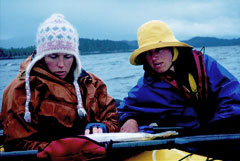
All in our early twenties, we came together in the final six months before our take-off as an eclectic mix of hometown buddies, co-workers in the outdoor industry and newfound friends. As it turns out, we all come from families of sisters. We have made the decision to make this journey without a designated expedition leader and, instead, to be committed to listening to the most conservative voice in every situation.
Packed up, we pile into Buffy’s van, driving north, away from the phones, faxes, sponsors and media that helped bring this whole thing together. It’s a relief, but we are also leaving behind the friends, boyfriends, family and strangers, whose support inspired and energized us. After three days of driving and ferries, we arrive in Port Simpson, BC, near the border of Alaska, in the evening. We settle in for the night on a little beach beside the dirt road. The sun lights the snow-capped mountains to the east on fire while the full moon rises up behind them.
We awaken to bright sunshine the next morning, and begin the arduous task of packing a month’s worth of supplies inside our boats. We wrestle our gear into our boats. Even when every hint of space is crammed full, there are still a few things that won’t fit. The bag of fresh vegetables must be left behind, but we somehow manage to squeeze in a backpacking guitar and a bag of wine.
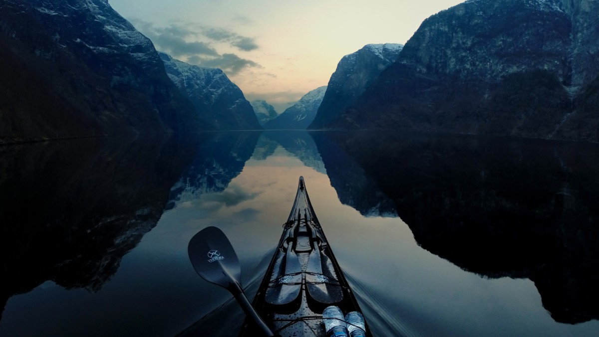
We climb into our kayaks; they sit low and heavy in the water. We plan to paddle north to the B.C.-Alaska border so that we can stake a claim to having paddled the entire West Coast. As we gather speed, our momentum steadies our rhythm. The swell rises and falls beneath my boat—residual energy rolling in from storms on the open Pacific. We are still nestled in the protection of the outer islands, which break up the ocean’s waves on their long, sandy beaches and tall, rocky cliffs. In a few days, we will be traveling southwest, paddling in the turbulent zone where the sea collides with the land.
After only six miles of paddling, we near the imaginary line of the border at Father Point, and decide to pull off for the day. We spend our first night near Father Point on Mother’s Day. An eagle perches on a tree above us as Jody and Kris make dinner. Buffy is kneading bread dough for tomorrow’s lunch in a large, sooty pot. I sit on the 50-foot-wide cobble beach and stretch, watching the tide creep toward us. I’m exhausted. Not from the day’s short paddle, but from everything else that it took to get to this point. I feel sheepish, but I ask anyway, “What do you guys think of taking tomorrow off?” Robyn pauses for a moment, then gives her whole-hearted approval, and the rest of the group follows suit.
After the day of rest, we paddle southwest the next morning. In the afternoon, we settle in on a cobble beach on Burnt Cliff Island. Jody, Kris and I paddle over to a nearby island to fetch water from a meandering stream. We paddle up the stream through the lush, green forest until we can no longer taste salt in the water. When we get back to the beach, the 25-foot tide begins its retreat. Within a couple of hours, the ebbing sea reveals a sharp drop just beyond the island, followed by seemingly endless mudflats that almost reach the island across from us. It will be impossible to leave the island at any time other than high tide.
We pull out the tide tables and find out that the next high is at three in the morning. We could wait for the afternoon tide the next day, but by then the winds are bound to have picked up. Instead, we head to bed early and get up in the middle of the night. I strap on my headlamp and stuff my sleeping bag with cold hands. We paddle south into a light drizzle and a steady headwind. Paddling in the front of the double, I gradually realize that I haven’t dressed warmly enough. I snug my fleece hat over my ears and fasten my pogies onto my paddle. A chill sets in to my spine and my hands become numb. I twist from side to side with every stroke against the wind, trying to warm up.
The sky turns from black to purple to pink to white. After several hours, we pull off for a break. We round a point toward a muddy pull-out just wide enough to squeeze our kayaks into side-by-side. Dozens of bald eagles are perched on the rocks to our left, some hopping around each other, others sitting still, their smooth white heads twisting to watch us. We glide past them slowly at eye-level, only 30 feet away, but they do not fly off. As the bow of the double rubs into the sand on the beach, my hands are stiff and curled around the shaft of the paddle. I climb out and swing my arms in circles as I walk around on the flat, muddy beach. Kris pulls out a stove and pot and heats up some water. We fill up our mugs with instant potatoes and cheese. Swallowing spoonfuls of the hot, gooey mash, I finally begin to warm up.
Several days later, we decide to head north for a day to explore the Stephens Group. It will be our first day on the outside, and we figure it will be a good warm-up, because it has lots of pull-out options, rather than immediately heading south past Porcher’s long, smooth shoreline. We edge our way up along the western shore, paddling against a light headwind as we round a series of points. We take a quick break in the protection of a south-facing, muddy bay on Perry Island. When we get back into the boats and paddle out of the bay, the waves have darkened and swelled. We decide to exit the bay through a tight gap between Perry and a house-sized island. Jody heads through first, with Robyn and Buffy following her in the double. Now it’s my turn to paddle into the gap. The waves stand up and crash over my deck as I inch my way through the constriction between the two islands and out the other side. The sea on the north side is alive and rolling. The wind belts in from the northwest and I stare out at the open ocean ahead and to the left. I focus on keeping my boat heading straight into the whitecaps as my bow smacks down between each of the waves. Kris edges up beside me and I glance over at her and yell, “I’m not comfortable here.” I call over to the others to wait while Kris and I paddle up beside them. We rise and fall with our bows pointed into the breaking waves and discuss our options. The waves are too big to turn around in comfortably and, even if we did turn around, it would be difficult to take the waves from behind and sneak back through the gap. I do not want to go forward, because we will expose ourselves to even bigger swells if we round the next point. The mouth of Stephens Passage, on the north side of Perry Island, lies about a mile to our right, and appears to be the best option. It would be nearly impossible to take the waves broadside, so we ferry to the right and work our way into the protection of the passage. It’s a slow process. I paddle gently, my feet staying light on the foot pedals as I adjust the angle of my boat. I try not to gain any forward ground, and the land to the right gradually grows nearer. Within a few hundred feet of shore, the water settles and we turn our boats east and head into the passage. After the riotous waves, the calm of the channel is almost surreal. We find a shell beach with enough room to lay out our bivy sacks. There are no creeks nearby, but we have enough water in our bags to last us a few days.
We sit around in the occasional glints of afternoon sun, but no one says much. I am happy that the group listened to my discomfort, but the silence is heavy, and conveys a discomfort with the day’s paddle. Finally, Kris starts talking. We had paddled out onto rough water almost blindly, without a back-up plan. Our first real day on the outside and we were sent scurrying. We were so driven to keep exploring that we didn’t think about what the water was like beyond the gap. It’s a good wake-up call for all of us, a reminder that we must always stay alert along the outside; there is little room for mistakes out here.
The next day is calm, and we easily make our way down to a beach on the south end of Porcher Island, where we camp for the night.The next morning, I awaken to the thumping of the rain fly against the side of the tent. Wind sends surges of raindrops hammering against the roof. I pull on my fleece and rain gear before unzipping the vestibule and stepping out. The wind whips across the water, turning it a frothy white. I stand for a moment, feeling the cold raindrops pelt onto my cheeks, then I duck my head down and wander over to the others.
They are serving up mochas, huddled underneath a tarp in the shelter of a boulder that stands twice my height. A pot of cold, charcoal-scented oatmeal sits neglected beside the stove, for which Buffy takes the blame. We pull out the chart of Banks Island, which we should reach in a few days.
We discuss whether to paddle the outside of Banks Island, or to go with the safer inland channel. There are no bays to offer protection from wind, swell and fog, and no beaches for a soft surf along the entire 35 nautical miles of the western shoreline, which is exposed to the constant pounding of surf. Numerous boomers here lurk beneath the surface, making navigation both difficult and dangerous. This is not a mountain climb, in which some members can head for the top while others wait back at camp. The only way that we will paddle the outside of Banks is if everyone agrees that we can pull it off safely. Kris is adamant that we can make it down the outside, while Buffy and Jody are unsure whether the possible consequences are worth the risks this early in the trip. Without coming to a resolution about Banks Island, we put the debate aside for a while.
The wind continues to billow the tarp, and pebble-sized rain drops drive horizontally underneath it. We hunker down with hot drinks and chat about everything from our families to our futures to boys. It’s Robyn’s birthday, and we stealthily bake a chocolate cake right in front of her, without her noticing. Kris cooks up a dinner of sautéed bull kelp and dehydrated vegetables over rice, while Jody and I sneak off down the beach in the pelting rain. We find a bright-yellow construction helmet that has washed up to use for Robyn’s birthday hat, and wrap a chunk of blue fishing rope around it, then style it up with a smattering of colorful wildflowers and seashells. Robyn grins as we present her with the colorful gift. As we finish our dinner, we realize that it is midnight and that we have lost track of time under the northern sun. Before heading off to sleep, we divide the cake and polish it off.
By morning, all that’s left of the storm are tangles of olive-colored kelp strewn down the beach, the rolling crash of a three-foot swell and the occasional gust of wind whipping through my hair. There is a palpable sense of excitement in the air as we prepare to get back onto the water. Buffy and I dance down the beach popping the bull kelp heads before we pack up our gear. The tide is low, so we boost the kayaks onto our shoulders and carry them 500 feet to the water’s edge. One by one, we launch into the surf and wait out beyond the break, then we turn south, and paddle out past Gochien Island.
Two days later, camped on Squall Island, we still haven’t come to an agreement about which route we should paddle around Banks Island. The afternoon wind builds to 30 knots, and we look out from the protection of our bay to see a 40-foot fishing boat struggling and heaving its way north through the dark, crashing sea. After two days of being pinned here by the wind, we look at the chart one more time and listen to the weather forecast. In order to paddle the outside route safely, we will need a day and a half of good weather, but the report doesn’t offer much hope. After hours of discussion, we finally decide to stick to the inside. To allay our sense of disappointment, we decide to give ourselves a different challenge: We will paddle the entire 35 nautical miles along Banks Island in a single day.
The next morning we hop onto the water and head south, keeping a steady forward pace all morning. Around noon, I hear a soft “puff” sound in the distance. I pause and hear another. I scan the horizon. A six-foot, black fin emerges a couple hundred feet ahead of us. Orcas. A smaller fin appears briefly, then a calf surfaces behind it. I hold my breath and wait to hear them again. They rise again the same distance away, this time to the right of us. The pod is quickly heading north, surfacing now and then as it moves into the distance.
The water stays calm and there’s a light northwest wind as we make our way past Banks to the southern tip of Pitt Island. When gales begin blowing the next morning, we realize that we made the right choice of routes.
Five weeks into the trip, we arise at 5:00 on the northern end of Price Island. It’s another surprisingly dry, warm day. I awake to the unzipping of Jody’s bivy sack beside me on the beach. I didn’t hear my watch’s alarm. The crackling of the weather radio breaks the morning silence and we all reach for our pens and logbooks, to record the daily forecast. Robyn imitates the smooth, sexy voice of the computerized woman who gives the ocean buoy reports, and we all chime in, laughing. The weather should be good, and Buffy is soon at the stove, firing up hot drinks and a pot of Cream of Wheat.
I unfold my fleece shell that was tucked under my head as a pillow the night before, and slip it on. Cringing slightly at the cold, I slide my feet into my dew-covered sandals that are lying beside me in the sand. Now it’s time for the grand schlep of lugging dry bags, tarps and food to the water. The tide is creeping up the beach, and we carefully gauge where we set our gear so that the boats will be floating as soon as we are ready to climb into them. We have no assigned tasks, just a common goal of being on the water by seven.
As I walk back up the beach, I notice a commotion around the stove. Buffy is laughing and Robyn is vigorously stirring the pot while Jody dumps water in. It seems that Buffy thought that she should cook up an entire pound of Cream of Wheat for breakfast, when we usually use just a cup. I walk over and peer into the mass of white lumps in the pot. We officially ban Buffy from any breakfast responsibilities, after her creations that Robyn has dubbed “scorchmeal” and “cream of lump.” After chewing on our porridge, we pack up the rest of the gear and head to the water. One by one, we drift away from shore. Robyn brushes her teeth while drifting in her kayak, and Jody floats nearby, putting on sunscreen. As soon as we are all out, we point our bows southward and begin to paddle.
My boat rises and falls on the swell, the water undulating like mercury in the gray morning light. Every now and then, the others disappear from view as I sink into a deep trough. The black nylon cover on the seat has a damp, stiff, familiar feel and the paddle sits comfortably in the callused crooks of my sun-baked thumbs as my body twists from side to side propelling the boat forward. A rhinoceros auklet—a small bird with a bulge on its beak that makes it look like a wise old man with a set of spectacles resting on his nose—skitters along the water’s surface as I approach it. We’re paddling a mile offshore, to avoid the threat of boomers and shoals. As the hours pass, we make our way ever closer to the south, to the protection of the myriad rocks and islands at the south end of Price that will dissipate the eight-foot swell into calm.
As the wind scours the water’s surface, I look back over my right shoulder and notice a darkening on the western horizon. Still an hour from the protection of the southern end of Price, I attempt to pull more water past me with every stroke. Jody has seen it too: “Let’s get going, that looks nasty.” The white lips of the waves slap the stern and rush beneath me. Wisps of hair blow across my face and the whistling of the wind gets louder. I forget about the dampness and my calluses, as I keep my eyes fixed on the sheltering land to the south. Now and then, waves exploding into millions of white shards on the shoreline 800 feet to my left capture my attention. Wave after wave, larger and larger, pushes underneath me, trying to pick me up and send me into the frothy water and rocks. I am forced to paddle backwards now and then to slow my kayak and avoid the shoreward momentum of the seas.
As I paddle hard, between wave sets I catch glimpses of the other boats beside me. Robyn shouts from ahead, “Let’s pick up the pace!” The waves stand even taller as we approach the shallows between the rocks, shoals and tiny islands. I search for a break in the crashing waves through which we can sneak behind a shoal. From behind me, Kris shouts, “Head in behind that rock!” Waves slosh over my spray deck and I taste salt as they splash up into my face. Back paddle, paddle hard forward, back paddle again as the boat rises up and leans down the wave. Finally, I can feel my boat become steady as I glide in behind a rock covered with rockweed and barnacles. Tucked into the protection of the shoals, the ocean calms, and the rise and fall become subtle. The wind pushes gently at our backs, nudging us eastward past McGuiness Island and the other small islands at the southern tip of Price.
 Five weeks later, within a day’s paddle of the Brooks Peninsula, Robyn’s forearms are beginning to scream. Each of us has suffered through aching backs, sore arms and cramping butt muscles, but nothing has been as painful as this. In the last few miles of the paddle, Kris and I both offer to tow her or switch her into the double, but she firmly and persistently paddles on. Forearms are one thing you cannot do without on a sea kayak trip. We land at Restless Bight and wait a day for gales to blow over, a day for Robyn’s arms to rest. To the south, the mountainous Brooks Peninsula juts nine miles out from Vancouver Island. Fishermen we met two weeks earlier told us stories of cats-paws swirling out of the sky there and whipping water into the sky, capsizing fishing boats.
The next morning, I am paddling the double with Robyn in the front. We’ll be paddling the final 17 nautical miles to the northeast side of the Brooks Peninsula. Robyn attempts a few strokes, but soon stows the paddle blade under the bungie in front of her. The double is a beast at the best of times, and paddling it alone is a challenge. I engage my whole body with every stroke. Within a half-hour, as we round Lawn Point, the swell stands up to form nine-foot waves and troughs. We keep our eyes focused ahead, vigilant for waves that might threaten to break. Jody’s and Buffy’s singles are getting farther and farther ahead, while Kris paddles alongside Robyn and me. The double feels solid and steady beneath me as the waves roll underneath it, and Kris is having fun playing beside us in the giant swell. We try to keep up to the other two, but it’s futile. They are barely within shouting distance now. I cannot understand why they have gone so far ahead. They must be less comfortable than Kris, Robyn and I, but I cannot understand why we have become so spread out, especially when Robyn is unable to paddle. We continue inching our way around the point. Jody and Buffy have paused around the point, where the swell has settled out. Robyn and I slide in beside Jody and Buffy. They look at us with concern, and Jody says, “I think we should pick up the pace.” I am surprised, and don’t understand the need to hurry. Over the past few months, our travel style has melded, and there are now very few instances when we disagree on the water.
We paddle another six miles alongshore to a lunch spot on Heater Point. The black pebble beach is too hot to walk on in bare feet. We sit on giant driftwood logs in the sun, and try to figure out why we got so spread out and what was going through each person’s head. Jody and Buffy were not comfortable in the steep swell. We all have had moments when we weren’t comfortable. I had made the group turn back the first time we hit big seas at Dolly Island. Kris didn’t want to paddle on a windy day when the route was laced with cliffs. Jody had had a bad feeling about the fog at Cape Caution, and Robyn was uncomfortable on a windy crossing from the West Kinahan Islands. On this occasion, I couldn’t go any faster and, like Robyn and Kris, I was not overly concerned with the sea state. The lack of cohesion was a good reminder for all of us that it’s easy to get spread out and lose touch on the water. With that in mind, we launch and paddle onward to the Brooks.
We awaken the next morning to a big blue-sky high-pressure system that is centered just south of us, sending a northwest wind of up to 35 knots barreling in across the water. Our campsite is in a little bay protected from the wind, so we laze around for the day in the hot sunshine and watch the white-capping sea through binoculars. The Brooks Peninsula is a square chunk of mountainous land that juts nine nautical miles out into the sea. The chart gives no guarantee of safe pull-outs for the 19 nautical miles around it. The gale warning continues for another five days and, while we wait to paddle the most challenging section of the journey, Robyn’s arms have a chance to heal.
At last, on August 2, the gale warning is lifted, but we wait for the tail end of the wind to settle out as we load our gear and climb into our kayaks. It’s 4:00, and we plan to paddle ten miles to a potential pull-out at the tip of the peninsula to camp for the night.
Around 7:00, we approach the end of the Brooks Peninsula. The water is as calm as an inland lake, and I have never before seen so many birds. Cormorants are gathered on a rock and chatter loudly amongst themselves. Seagulls fly ten feet over my head and gather in groups on the water. Rhinoceros auklets wiggle along the surface of the water, their little legs kicking. They try to stay away from us, and dive when we get within 15 feet. Puffins, with their white masks and broad, bright-yellow beaks, swim around, and sea otters and seals pop up nearby.
As we approach the pull-out spot, Jody suggests that we re-think our plan. If the wind picks up in the morning, we will be trapped at the tip of the Brooks. If we keep paddling, we will be traveling and landing in the dark. We are divided as to what to do. I’m not keen to surf-land at night, but I don’t like the thought of being held up any longer on our route. We are drifting toward land and must make up our minds quickly. We decide to push on to the southeast section of the peninsula.
We munch on fruit bars and bread for dinner. Darkness sets in, and we strap on our headlamps. I stare at the chart on my deck, at the peninsula ahead and to my left, trying to discern the shadows of land from each other. A beach on the chart looks promising, so we paddle toward it. We can hear the rush of water on steep gravel as the swell surges in and out. Buffy looks over at me: “It’s too steep, let’s keep going.” Our paddles set off swirls of glowing green light, and my boat’s bow wake glows. We sneak along near shore, looking for the next possible landing. We find a shallow bay with a reef blocking its entrance, protecting it from the swell. Just off the beach, we pause with our headlamps focused on shore as Kris lands her kayak through the small surf. We each follow behind her. It’s now nearly midnight and we’re ravenous, so we heat up instant potatoes and cheese before crawling into our bivy sacks for the night.
Jody is nauseated the next morning, but she insists that we get on the water and make our way to our next re-supply spot. In the front of the double, she puts in an effort to paddle, often resting her head on the deck. By evening, when we reach a pull-out near Kyuquot, she’s still ill. The next morning, we paddle to a Red Cross station in Kyuquot. By now she is unable to hold down any food. The nurse practitioner diagnoses a combination of stress, exhaustion and the flu, and she takes all of us into her home for three days while Jody recovers. When we finally leave Kyuquot, we crank for two days down a steep-walled, rainy inlet to reach our food pick-up in Nootka Sound. Somewhat exhausted, and with many miles to go, we head into the fourth month of paddling. Ahead of us is Estevan Point, with its shoaled coastline and storybook white lighthouse. As we approach the point, a dark fog bank thickens on the horizon, so we sneak our way to shore on a path that the keepers have cleared through the boulder-strewn shallows. The tide rises as we pay a visit to the lighthouse keepers, eat lunch and gather handfuls of huckleberries.
After a couple of hours, the fog creeps away. The tide has swallowed our pathway, and we are forced to dodge rocks through the swell on the way back out. We paddle a mile offshore to avoid the near-shore rocks and shoals. Within twenty minutes, seemingly out of nowhere, the thick fog engulfs us and removes all visual bearings. Buffy wants to turn back, but Robyn and I are not so sure. “We can’t go back now, our pathway is gone and there’s no way to pick our way to shore in the fog.” At this point, there is no conservative option. The option to turn back is as daunting as it is to go on. The moan of the foghorn and the swell crashing over the shoals to our left break the silence. We rise up and down on the swell, straining our eyes to see some form of land.
We decide to continue south around the point for the next few miles, and then head east to get protection from the swell. We will be forced to rely on a compass to guide us. Kris takes a look at the chart and pulls out her compass. I hesitate to paddle too forcefully, not wanting to move too quickly into the fog. At the same time, I want to reach the reassurance that being on solid ground gives me. After what seems like hours, treetops begin to emerge from the white as we make our way to a pull-out on the south side of the point. Dealing with a day like today would have seemed impossible a month or two ago, but today it feels only slightly more difficult than any other day out on the water.
Throughout the last month, we paddle in sunshine, each day bringing us closer to Vancouver. On August 19, I watch the sun sink straight into the water for the last time, before we head into the shelter of the Strait of Juan de Fuca. Washington’s Cape Flattery mellows the swell. We watch the waxing moon in the sky.
Two weeks later, under a full moon, we sit on Bowen Island staring at the city lights just nine miles away.
The next morning, on September 5, we approach Vancouver’s Ambleside Beach. We paddle close beside one another. By now, our kayaking and navigational skills have merged. It no longer feels like we are just five separate individuals. It is almost as though our minds have melded and we have become extensions of a single entity. In the 119 days and 1,140 miles we have been traveling, there have been many moments when we were challenged and came through for each other—as sisters do. Our family and friends stand waiting for us on the beach, calling out to us as we take our last strokes—together.