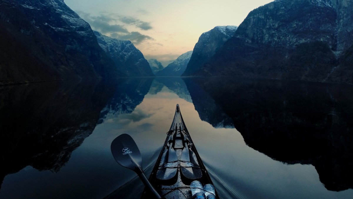

Head down, into the wind, paddling north towards Missisquoi Bay in Lake Champlain, I yelled across the water to the woman in the gray kayak ahead and to my right.
“Hey, Martha! What was that you said about wanting to kayak on a big freshwater lake because you don’t like the way tidal areas smell? I’m not so sure freshwater lakes smell any better. We’ve been downwind of some big dairy for ages now!”
Martha laughed and yelled back, “I don’t know. The chart says that’s Hog Island Point. Maybe we’re downwind of a pig farm. Can you smell the difference between cows and pigs?”
Jim joked with us about honing our “odor identification” skills, learning to distinguish aromas wafting over the water, whether they were a combination of silage and cow manure or just plain cow manure.
This trip wasn’t turning out quite the way we had planned it. Martha had convinced me to try something new for us, an extended kayak trip on freshwater instead of our usual trips to the coast of Maine. I thought I’d miss the dynamics of tides and ocean currents, but Martha had reassured me that there would be no hauling of gear and boats across intertidal areas, and that the lake would be warmer than Maine’s frigid waters, perfect for swimming without ending up with a salty coating on our skin. It sounded good to me.
We’d heard that the Missisquoi Delta area was a lovely place with lots of migratory birds and the Paddlers’ Trail Guidebook made it sound like one of the wilder parts of the lake. We hoped to see lots of ducks and geese as well as herons.
What I hadn’t expected was to find Lake Champlain looking like the tide had gone out. The lake doesn’t have daily tides but its level fluctuates between 6 and 9 feet over the course of the year. It is highest in the spring after the snow melts and lowest in the fall as the waters slowly drain out the Richelieu River to the north. This year was one of the driest on record for Vermont, so the lake level in September was near record lows.
 When we paddled up around the Delta headed to Highgate Cliffs on the eastern side of Missisquoi Bay we found out just how low the lake was. What looked from a distance like navigable water was only a thin layer of water over mudflats choked with weeds and algae. Frustrated by the heavy clumps of weeds that clung to my paddle blades as I pulled them out of the water, I eventually developed what we called the Missisquoi stroke. Instead of pulling the blade straight up and out of the water at the end of a stroke, I slid the blade towards me before lifting it. It was slow going, but it kept the weeds off the blade.
At some point, even a special stroke didn’t make up for lack of water under the boat so Martha and I got out and pulled our boats with the bowlines slung over our shoulders. Jim had swung wide and away from the Delta and managed to keep paddling. Looking down at the slime streaked on my legs, I hoped we could find a place to swim when we got to the cliffs.
The slime didn’t end with the Delta. When Martha and I resumed paddling, we stopped to talk with several fisherman sitting in a big power boat. Jim commented on all of the algae and one of them said, “Well, that’s what you get when you have 9,000 cottages dumping their gray water directly into the lake.”
Warm temperatures, shallow water, and far too many nutrients from the lakeside dairies and farms, as well as all the lakeshore cottages, meant that all of Missisquoi Bay for as far as the eye could see was coated with a half-inch layer of bright green algae.
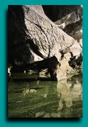
Highgate Cliffs, when we reached them, were as lovely as we’d hoped they would be. The water was warm and still, but knowing what I did about the water, I wasn’t about to go swimming. Stepping out of the kayak and wading into a rocky beach near the base of the limestone cliffs, my lower legs looked like the rocks along the water’s edge-coated with a layer of green algae. I wiped down my legs with my bailing sponge, and decided to look for a shady place to lounge in my camp chair.
Amid the rocks on the beach, I saw a big frog that was the same color as the lake algae. It stood still long enough for me to get a good look at its bright green spots and a chance to count its legs. I don’t normally count legs when I see a frog, but I’d read in the Paddlers’ Trail Guidebook and some other places about how the shores of Lake Champlain had an unusually high percentage of deformities in frogs and other amphibians. Scientists haven’t figured out why, but pollution in the lake is one possibility. After we stared at each other for a while, the frog hopped into the shade of the shoreline shrubs. It had the appropriate number of legs.
Algae blooms, thick weed growth, frogs with extra legs-even though I’d read about these things, I’d rarely come face to face with such strong evidence of serious environmental problems on a paddling trip. I was disturbed to see such a lovely place showing signs of ecological distress.
Concern about water quality issues and invasive plants and animals in Lake Champlain may be new to me, but it has been a concern for New York and Vermont for most of the last century. Both states have built facilities to treat the wastewater and runoff that flows into the lake water. Lake Champlain has three major types of water pollution-excessive levels of phosphorus, localized bacteria, and heavy metals and other toxic chemicals.
PHOSPHORUS
Phosphorus is a naturally occurring nutrient that is necessary for plant growth. It’s a major ingredient in many lawn and garden fertilizers. Phosphorus becomes a problem when excessive amounts of it end up in a body of water. High levels lead to increased plant growth and algae blooms like what we paddled through in Missisquoi Bay.
Besides being unsightly and hard to paddle through, algae blooms deplete the oxygen in the water, which hurts native fish species. Algae blooms in Lake Champlain can become toxic. In 1999, three dogs died after drinking an excess of lake water and ingesting toxic blue-green algae. On August 3, 2001, a temporary health advisory was issued in Vermont, warning people to keep children and pets out of the lake.
The three main sources of phosphorus are agricultural runoff, stormwater runoff, and wastewater and sewage discharges. Stormwater runoff occurs when rain or melting snow flowing over roads, parking lots, lawns, and rooftops flows into streams and rivers that feed into the lake. With increased urban and suburban growth around the lake, stormwater runoff is becoming a greater problem for the lake.
Although agricultural runoff is still the major source of phosphorus pollution in the lake, acre for acre, developed land contributes three to six times as much phosphorus as farmland does. Wastewater flowing through inadequate or overburdened sewage treatment facilities in the Lake Champlain watershed also contributes to the pollution of the lake, both as a source of phosphorus and bacteria, but recent improvements in wastewater treatment have improved the situation.
And then there are the cows. Vermont is famous for its dairy products and a lot of them come from the Champlain valley. All those cows produce a lot of phosphorus-rich manure. When it rains or the snow melts, nutrients leached from the manure run downstream to the lake. One source of phosphorus pollution-the spreading of cow manure on frozen fields in the winter-has been banned in Vermont, but still continues on the New York side of the lake.
BACTERIA
Increased levels of bacteria in the lake, such as E. Coli, have caused sporadic closures of some swimming beaches. Two beaches, Blanchard Beach in Burlington, Vermont and Essex Beach, New York, have been closed for swimming indefinitely due to elevated bacteria levels. A cleanup operation is in the works at Blanchard Beach. Sources of the bacteria include what are called “point sources”-specific places such as sewage treatment plants-as well as “non-point sources”-such as dog waste.
HEAVY METALS AND TOXIC CHEMICALS
Heavy metals, such as mercury, and toxic chemicals, such as PCBs, are a major factor in the water quality of the lake. High levels of mercury and PCBs have concentrated in the lake’s fish, especially the larger fish such as walleye and lake trout.
Both Vermont and New York have issued health advisories cautioning people to limit their consumption of fish caught in Lake Champlain. The New York State Board of Health advises that women of childbearing age and children under 15 should not eat any fish from Lake Champlain. One area of Lake Champlain, Cumberland Bay near Plattsburgh, New York, was the most significant known toxic waste site in the lake, and thought to be the primary source of PCB contamination in the lake’s fish.
Years of wastewater discharge and dumping of sludge by wood products industries near Plattsburgh were the source of Cumberland Bay’s PCB contamination. In 1999 and 2000, an extensive dredging project, costing over $30 million, removed approximately 140,000 tons of dewatered PCB-contaminated paper sludge from Cumberland Bay and took the sludge to approved disposal facilities. The concentration of PCBs was reduced to below hazardous levels and local residents are looking forward to enjoying their beach for the first time in half a century.
INVASIVE PLANT AND ANIMAL SPECIES
Invasive plant and animal species, including zebra mussels, Eurasian watermilfoil, and water chestnuts, pose another threat to the health of Lake Champlain. Most of the weeds I was trying to keep off of my paddle with a special stroke in Missisquoi Bay were Eurasian watermilfoil. A feathery, fern-like plant that grows on the bottom in shallow areas, its dense mats are more than just a nuisance for kayakers.
It also displaces native plants and provides little food value to wildlife. Eurasian watermilfoil first appeared in Lake Champlain in 1962 and has since spread to many of the shallow areas and bays of the lake, as well as other bodies of water in the Lake Champlain watershed. Because it can grow from stem fragments, it is easily spread between bodies of water by plant parts stuck on boats and boat trailers. (See “Marine Invaders,” SK Dec. ’01.)
On an island in the main body of the lake, I saw rocks covered with clumps of small, striped mussels. Zebra mussels came to Lake Champlain in 1993, likely spread as free-floating larvae in boat ballast and bait water or as adults stuck to boats. In less than ten years, they have become one of the lake’s most problematic invasive species, spreading through the lake and causing many economic and environmental problems.
Zebra mussels are the only type of freshwater mollusk that attaches itself to solid objects. Because they can live in a wide range of habitats, eat everything, and reproduce rapidly and prolifically, they are quickly outcompeting native mollusks. It’s not just other mollusks that feel the impact of zebra mussels. Water facilities, fish hatcheries, and industrial plants have spent over $5 million to keep zebra mussels from clogging intake pipes. By feeding from the water column, zebra mussels move phosphorus from the water to the sediment in the form of their waste product.
During my trips on the more northern areas of the lake, I didn’t see any water chestnuts. Currently, this non-native plant is found only in the southern parts of the lake where in some places it is so dense as to make boat traffic almost impossible.
Now there is concern that it may spread to the Missisquoi Bay area. Water chestnuts have been found in Quebec’s South River, just two miles from Missisquoi Bay. Water chestnuts are spread by a barbed seed casing that can stick to the undersides of animals as well as boat parts. Purple loosestrife (a wetland plant) and sea lamprey (a parasitic fish) are also problems in the lake.
So, What’s a Kayaker to Do?
Given the algae blooms, weed-clogged bays, and toxic chemicals found in parts of the lake, should kayakers avoid Lake Champlain? Will I? Each paddler makes his or her own decisions about what conditions they want to encounter on a kayak trip.
I know that I’ll go back. There are many lovely parts of the lake I look forward to exploring. I have a better understanding of the condition of the lake and the threats to it. I also feel a greater sense of responsibility to do my part to try to help Lake Champlain recover from its environmental woes.
Here’s what kayakers can do, not only for Lake Champlain, but for waterways everywhere.
Help reduce nonpoint source pollution.
1. Become an active member of a local or regional watershed group.
2. Use conservation practices on agricultural lands.
3. Plant trees and vegetation to help hold soil in place and reduce erosion, particularly in areas next to surface water.
4. Properly maintain your septic system; pump every few years.
5. Wash your car with non-phosphorus and biodegradable soap on your lawn rather than on your driveway so that excess water and detergents can soak into the grass.
6. Do not use unnecessary fertilizers; first, have your soil tested.
7. Do not disturb ground cover unless absolutely necessary.
8. Do not rake your yard waste into nearby streams, lakes or stormwater gutters.
9. Do not pour chemicals or motor oil down storm drains or into septic systems.
10. Do not use soaps or detergents that contain phosphorus.
11. Properly dispose of dog waste, preferably in a toilet.
Don’t contribute to the spread of invasive plants and animals.
1. Learn what invasive species are in the waters in which you paddle, how to identify them, and how to keep them from spreading between bodies of water. Each time a kayak or other item is used in water bodies infested by zebra mussels or other nuisance aquatic species, the kayak and equipment should be carefully inspected for evidence of these species. Remove any mussels or vegetation and dispose of them in the trash.
2. Drain all water from your kayak at the water’s edge before you load it on your car and head home.
3. Dry the kayak (and paddling gear such as wetsuits and PFDs) in the sun for at least five days after paddling in waters containing zebra mussels and before paddling in waters uncontaminated by zebra mussels. If you want to use your boat sooner or avoid excessive UV exposure to your gear, rinse off your kayak and gear with hot water or at a car wash.
4. Leave live aquatic bait and bait used in infested waters behind-either give it to someone using the same water body, or discard it in the trash.
5. When paddling in areas infested with Eurasian watermilfoil, be careful not to break apart the plant because milfoil spreads by plant fragments.
Leave No Trace
1. Practice impeccable Leave No Trace camping and outdoor travel skills.
2. Learn about the particular skills appropriate for Lake Champlain by reading information in the Lake Champlain Paddlers’ Trail Guidebook, or for general Leave No Trace information, visit the Leave No Trace Web site at www.lnt.org
Support the efforts of groups working on behalf of Lake Champlain.
1. Join the Lake Champlain Committee (sponsors of the Lake Champlain Paddlers’ Trail). Kayakers’ membership in the Lake Champlain Committee supports the continuing development of the Paddlers’ Trail as well as supports their advocacy, education and research work to protect Lake Champlain. Along with many other advocacy projects, the Lake Champlain Committee was instrumental in advocating for and monitoring the clean-up of PCBs from Cumberland Bay. An annual membership fee of $40 includes the annually published Lake Champlain Paddlers’ Trail Guidebook and Stewardship Manual.
2. Learn more about “Opportunities for Action: An Evolving Plan for the Lake Champlain Basin.” This plan is a pollution prevention, control, and restoration plan. The plan was endorsed in October, 1996 by the governors of New York and Vermont and the regional administrators of the US Environmental Protection Agency. The 1996 plan called for periodic updates, and 2001 marks the first revision of the plan. In October 2001, the Lake Champlain Basin Program released a draft of the update to the plan for public comment and review. Although the official public comment period is over, the program welcomes comments at any time. Visit the program’s Web site at www.lcbp.org to get more information about the Opportunities for Action plan.
3. Get Involved in programs to monitor and combat pollution and invasive species. Kayakers are an important source of information about the condition of Lake Champlain. The Lake Champlain Paddlers’ Trail Guidebook contains a Lake Health Observation Form that kayakers can use to record information about the sections of the lake in which they are traveling. The form contains sections related to Water Quality Conditions, Algae Blooms, Infestations of Aquatic Plants, and Stormwater and Wastewater Outfalls and Discharges. Complete the form and send it in to the Lake Champlain Committee anytime you paddle on the lake.
4. Become familiar with storm drain stenciling. Storm drain stenciling is an effective method to educate people about where water goes when it flows down their street and into the drains. Check out the Earthwater Stencils Web site (below) for information about how to get involved in storm drain stenciling.
5. Contribute to public awareness. Along with talking with other paddlers and friends, consider posting some of the humorous Urban Runoff Posters in places such as workplaces, schools, marinas, and outdoor stores. They are funny and effective educational tools. The Lake Champlain Basin Program has created a set of posters specific to the Lake Champlain Basin which are available on their Web site. The poster series was adapted from ones that were developed by the Washington State Department of Ecology and others. For information on how to get posters for use in other areas, check out the Earthwater Stencils’ Web site.